Difference between revisions of "ArcGIS"
Jump to navigation
Jump to search
| Line 3: | Line 3: | ||
|Has name={{PAGENAME}} | |Has name={{PAGENAME}} | ||
|Has icon=File:arcgis_logo.jpg | |Has icon=File:arcgis_logo.jpg | ||
| − | |Has icondesc= | + | |Has icondesc=ArcGIS Icon |
|Has image=File:arcgis_image.png | |Has image=File:arcgis_image.png | ||
|Has description=Professional GIS Application | |Has description=Professional GIS Application | ||
| Line 23: | Line 23: | ||
|outrotemplate=SoftwareTableOutro | |outrotemplate=SoftwareTableOutro | ||
}} | }} | ||
| + | |||
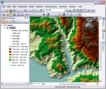
| + | ArcGIS for Desktop is used to compile, use, and manage geographic information. It includes a comprehensive set of professional GIS applications that support a number of GIS tasks, including: mapping, data compilation, analysis, geodatabase management, and geographic information sharing. | ||
| + | |||
| + | == Installation == | ||
| + | Click this link to be directed to our internal site for {{PAGENAME}} install instructions and download [https://makerhub-internal.georgefox.edu/wiki/{{PAGENAME}} internal site] | ||
Revision as of 10:34, 17 October 2019
| Web Page | Description | Version | |
|---|---|---|---|
| ArcGIS | Professional GIS Application | 10.7 |
ArcGIS for Desktop is used to compile, use, and manage geographic information. It includes a comprehensive set of professional GIS applications that support a number of GIS tasks, including: mapping, data compilation, analysis, geodatabase management, and geographic information sharing.
Installation
Click this link to be directed to our internal site for ArcGIS install instructions and download internal site

